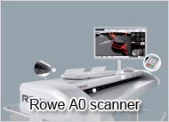
We understand you search a high speed A0 scanner to digitize your geographic maps with excellent image quality. The Rowe scanner is the perfect A0 scanner for your maps and plans. Scan your geological maps, groundplans, cable maps and all other A0 drawings with full precision. The A0 scanner creates digital files for an efficient workflow, also excellent basis for CAD conversion.
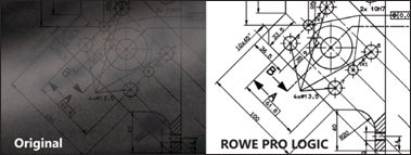
You would rather digitise your maps are high resolution. Every single details matters. You need the perfect scan to plan your construction. Also when you enhance vectorisation to GIS files, a standard scan is not sufficient. The Rowe A0 scanner is your perfect device to scan plans and maps. You can set the image resolution at maximum 2400 x 1200 DPI. Due to the turbo speed scanner you can still keep high productivity.